


February 2020
Wisconsin Coastal Atlas
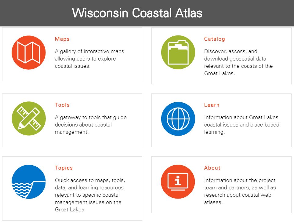
The Wisconsin Coastal Atlas is a technology platform that enables people to better understand coastal issues, share coastal data and inform decision-making about sustainable use of the Great Lakes.The atlas includes five elements: maps, catalog, tools, learn and topics. The atlas is built with an open architecture that allows easy addition of new maps, data, tools, and learning resources. Development of the Wisconsin Coastal Atlas began in February 2010 with funding from the University of Wisconsin Sea Grant College Program. The atlas serves as a gateway to interactive maps and decision support tools relevant to Great Lakes management and provides access to place-based learning resources about coastal issues in Wisconsin.
Audience & Decision Support
The Wisconsin Coastal Atlas is intended for use by coastal resource managers, planners, researchers, educators and coastal residents.The five elements of the Coastal Atlas work together to provide access to resources that can help address specific coastal management issues on the Great Lakes, such as building community resilience to coastal hazards.
(1) The Maps element of the atlas provides a gallery of interactive maps with customized perspectives related to specific coastal issues in Wisconsin.
(2) The Catalog element of the atlas provides several paths to discover, assess and download geospatial data for the Great Lakes coasts of Wisconsin.
(3) The Tools element of the atlas serves as a gateway to spatial decision-support tools relevant to coastal management on the Great Lakes. This is accomplished in two ways – first, by linking to innovative decision-support tools for coastal management, and second, by leveraging the spatial data catalog of the atlas to develop new spatial decision support tools.
(4) The Learn element of the atlas serves as a repository for place-based learning resources, promotes a stronger understanding of Great Lakes Literacy Principles and provides links to information about Great Lakes coastal issues.
(5) The Topics element of the atlas provides quick access to maps, tools, data and learning resources relevant to specific coastal management issues on the Great Lakes. At this point there are four topics relevant to southeastern Wisconsin included in the atlas – bluff erosion, coastal flooding, beaches and port/harbor/marina infrastructure.
Visit the Wisconsin Coastal Atlas