


Each month a different resource or tool that can assess shoreline changes, provide education on resilient practices, or support planning and policy development for coastal communities is highlighted on this page.
February 2022
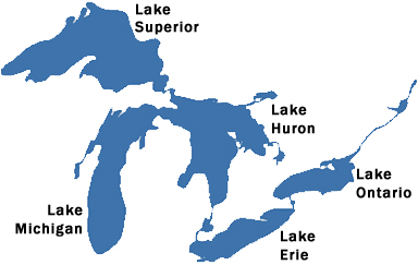
The Coastal Resilience working group is featured within the Built-Environment sector. Climate change is impacting wave sizes, water levels, and storm surges which impact the slope stability of the bluffs along the Great Lakes. The report offers potential solutions than can be enacted by city planners, resource managers, and residents.
January 2022
December 2021
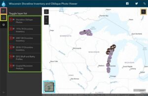 Updated: Wisconsin Shoreline Inventory & Oblique Photo Viewer – Featuring NEW photos from 2021
This interactive map is both a qualitative and quantitative inventory of shoreline conditions on Wisconsin’s Great Lakes coasts. It has recently transitioned to a new platform that utilizes ArcGIS. Additionally, it has been updated with 2021 aerial imagery. For more information on navigating the updated site, read through our image tutorial in the full article.
August 2021
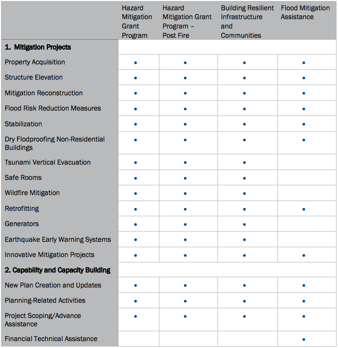 Summary of FEMA Hazard Mitigation Assistance Grant Programs
This fact sheet summarizes FEMA’s Hazard Mitigation grant and assistance programs. It includes general information about each program, eligibility information, dates and deadlines, application processes, and an explanation of the cost-share requirement. Additionally, it includes links to the relevant FEMA website pertaining to each topic.
July 2021
 Blue Accounting for the Great Lakes
“Blue Accounting is an information service to track the region’s progress toward shared goals for the Great Lakes. Maintained by the Great Lakes Commission, the information developed by Blue Accounting helps elected officials make sure that policies and programs are effective at protecting the largest fresh surface water system on earth.” This free, online database allows you to click through the three main segments of the website: Issues, Resources, and News. It is geared towards members of the public, decision-makers, students, research participants, educators, and anyone interested in issues regarding the Great Lakes. The Great Lakes Commission and The Nature Conservancy co-lead Blue Accounting and collaborate with federal, state, provincial, local and private sector organizations.
June 2021
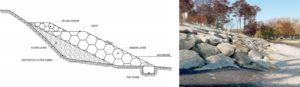
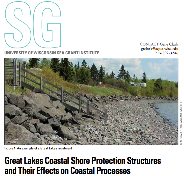 Great Lakes Coastal Shore Protection Structures and Their Effects on Coastal Processes
The publication Great Lakes Coastal Shore Protection Structures and Their Effects on Coastal Process reviews how coastal processes function on the Great Lakes with influences from the marine climate, area geology, weather, and human-induced effects. It also outlines three common Great Lakes coastal structures, what effect they have on wave action and therefore shoreline responses and scale of coastal protection. Lastly, this document briefly explains how coastal engineers model and monitor coastal structures and shorelines. You can download this document for free on the Sea Grant webpage.
May 2021
![]()
The Certified Coastal Practitioner™ Program
This program is hosted through the Coastal Zone Foundation. It provides participants with the opportunity to complete 10 out of 11 modules in order to obtain their Certified Coastal Practitioner™ credential. The modules go over high-level, introductory concepts related to each category presented by experts in the field. Coastal professionals, those in government, the private sector, coastal consulting, academia, and even coastal citizens are those most suited and would benefit most by completing this program, however, the CCP credentialing program is open to anyone to take. Working through coastal issues requires a multidisciplinary perspective. This credentialing program is designed to provide participants with a wide scope of resources and instruction on a variety of elements related to “modern coastal practice”.
Diving into the Digital Coast: Great Lakes
The NOAA Digital Coast is a clearinghouse for a wide variety of data, tools, and trainings related to coastal resiliency. The content found in these resources can be used by community leaders, the public and decision-makers to make informed decisions affecting the coast. This website can be a bit overwhelming at first glance so NOAA recently put out a training guide on how to navigate the website with resources related to the Great Lakes. Some of the highlights we have found to be excellent include the Data Access Viewer, a Working with Lidar Training, and Coastal County Snapshots tool.
March 2021

USACE Monthly Bulletin of Great Lakes Water Levels
The Monthly Bulletin of Great Lakes Water Levels is a set of online figures that depict past, present, and future water levels for each Great Lake. Published monthly as a public service, this bulletin shows recorded Lake levels from previous and current years, a projection for the next six months, lows, averages, and extreme lake levels from 1918 to 2020. This bulletin is intended to be used as a reference for general information about Great Lakes water levels to understand the annual cycle of lake levels in addition to monthly patterns and variability.
February 2021
 Funding and Financing for Coastal Resiliency
This webinar from the NOAA Office for Coastal Management’s is about financing coastal resiliency. In it, you will learn about different options and strategies for funding and financing for coastal resiliency projects. Presenters Leigh Whelpton, the program director for the Conservation Finance Network, and Erik Meyers, vice president for climate and water sustainability at the Conservation Fund will talk about their experience and practice in funding conservation-based resiliency projects.
January 2021
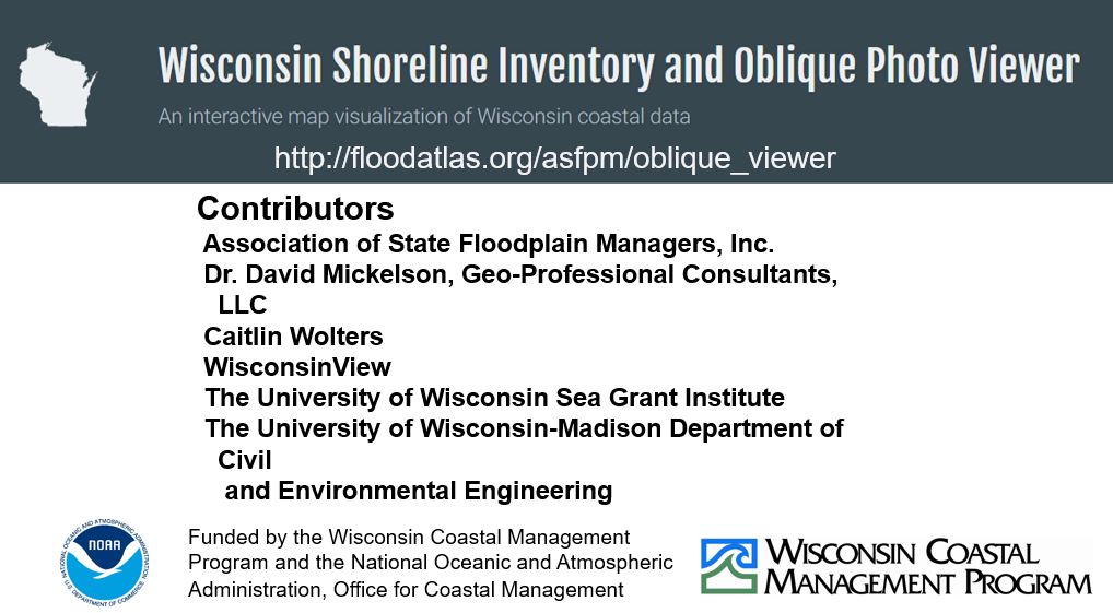
 Wisconsin Shoreline Inventory & Oblique Photo Viewer – Updated with 2020 images
This interactive map is both a qualitative and quantitative inventory of shoreline conditions on Wisconsin’s Great Lakes coasts. It has recently been updated with 2020 aerial imagery. Watch our tutorial to learn how to navigate the map and use the photos, shoreline condition inventories, and recession information to identify and prioritize areas for coastal management.
December 2020
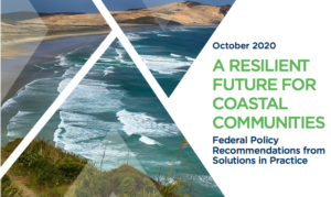 Resilient Future for Coastal Communities Report
This new report was released in October 2020. It highlights 30 federal policy recommendations for making coastal communities more resilient. It was developed from Congressional briefings involving coastal resilience experts across the nation. The report is available for free online. It is designed to be a useable resource for Congress, federal agencies, and the public interested in learning more about federal policy needs around coastal resilience. The report is organized into six major sections—Community at the Forefront, Land Use and Development, Cultural Heritage, Climate Adaptation and Resilience Data, Disaster Preparedness, and Financing Adaptation and Resilience.
November 2020
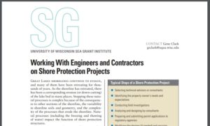 Working with Engineers and Contractors
Working with Engineers and Contractors on Shore Protection Projects is a four-page document that describes the standard procedures of a coastal protection project. In addition, the document highlights the benefits of using an engineering professional or contractor and provides recommendations for finding and choosing a qualified engineering professional or contractor that will fit the needs of the project. It is written for property owners or municipalities to utilize when they are considering a shore protection project. Readers can quickly read and understand the basics of employing an engineering professional or contractor to assist in a shore protection project. Check out the blog to find the link to a free download of this document!
October 2020
The Ohio Coastal Design Manual is put out by the Ohio Department of Natural Resources office of Coastal Management. This manual focuses on design and engineering principles of constructing coastal structures for erosion control. It provides a comprehensive overview of best practices for structure design. However, it is not too overwhelming for the general lakefront property owner. Even though this manual is geared towards engineers, surveyors, and contractors, it can serve as a great resource to bridge the gap between landowners and these experts. It is ideal for the development of a common language and knowledge basis.
September 2020
National Weather Service Great Lakes Portal
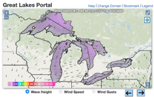 The National Weather Service Great Lakes Portal is an interactive tool for users to explore detailed weather information. This tool is hosted by the National Weather Service (NWS), a subset of the National Oceanic and Atmospheric Administration (NOAA). The landing page of the Great Lakes Portal allows you to see current and forecasted weather and hourly forecasts for up to 6 days in the Great Lakes region. This weather specifically includes wave height, wind speed, and wind gusts. This will be most useful for mariners, researchers, and even the general public because of the map’s ability to portray and forecast extreme weather events. Zooming into the map, the user is able to see more detail depending upon which layers are selected and the level detail provided. Layers include different hazards and risks (active, beach, swim), lightning density, wind direction, ship observations, radar, water levels, among others, all of which can be selected and deselected by the user.
August 2020
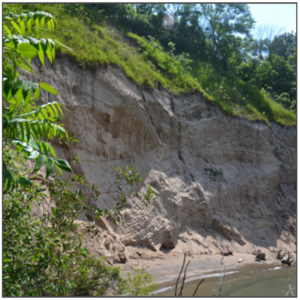 Protect your Home from Bluff Erosion: Fact Sheet
The fact sheet, “When Your Home is at Imminent Risk from Bluff Failure”, is put together by the Wisconsin Sea Grant to help homeowners understand when their homes are at imminent risk of bluff failure, what to do about it, and where to get more information. It is a simple 2 pager that lays out the most pertinent information about risk factors, options for repair, and who to contact.
July 2020
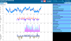
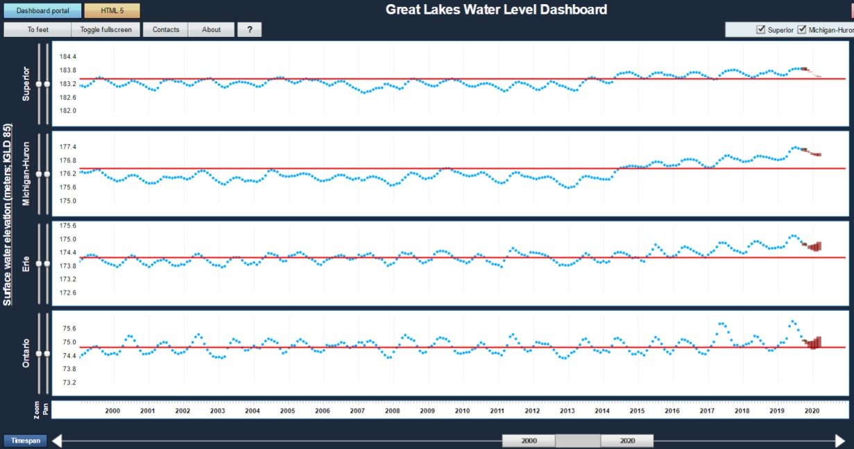
Great Lakes Water Level Dashboard
The Great Lakes Water Level Dashboard is a free, online, interactive website that portrays monthly water level information for all the Great Lakes. The dashboard allows users to view water levels, oscillation/pattern indices, percentages, hydrological input/output, speeds, temperatures, and flow rates. This tool is designed to support and be used by anyone interested in better understanding the long-term variations of water levels on the Great Lakes. The data is also updated frequently so users are able to download the most up to date data that is portrayed on the website.
June 2020
Green Infrastructure Code Audit Workbook
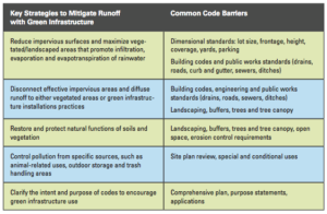
The University of Wisconsin Sea Grant’s Tackling Barriers to Green Infrastructure: An Audit of Municipal Codes and Ordinances is a tool for municipalities to use in order to identify codes and ordinances that hinder green infrastructure (GI) placement and suggest language to modify. There are 5 key strategies the workbook focuses on (1) reduction of impervious surfaces, (2) disconnection of effective impervious areas, (3) restoration of natural functions, (4) standards for specific land uses that can generate stormwater pollution, (5) encourage the use of green infrastructure in comprehensive plans, grant applications and purpose statements as the preferred approach to stormwater management.
May 2020
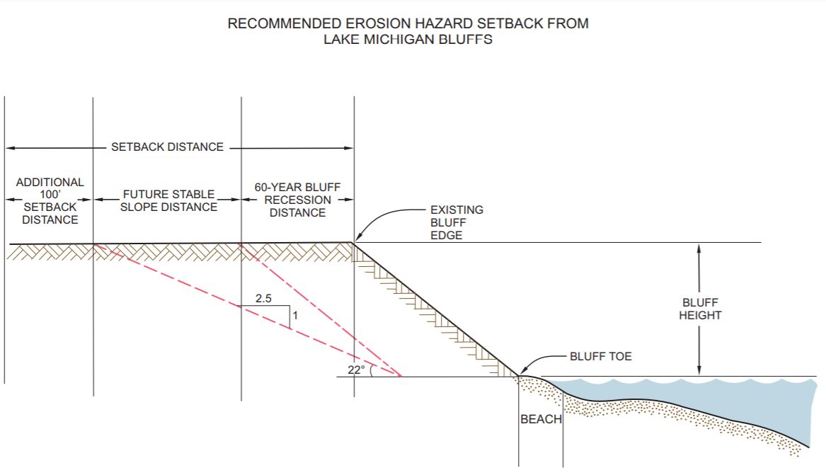
Model Ordinance for Lake Michigan Bluff Setback
SEWRPC’s model ordinance details an example community zoning ordinance that could help reduce the risk of developments being exposed to coastal hazards and limit the impacts of those hazards to the shoreline. The ordinance can include provisions on setback distances from the bluff edge for new development or redevelopment, building relocation, vegetation removal, stormwater management, on-site waste disposal, or the use of shore protection devices, as well as requirements for engineering or geotechnical analyses of proposed site modifications that may affect safety or bluff stability.
March 2020
USACE Great Lakes High Water web page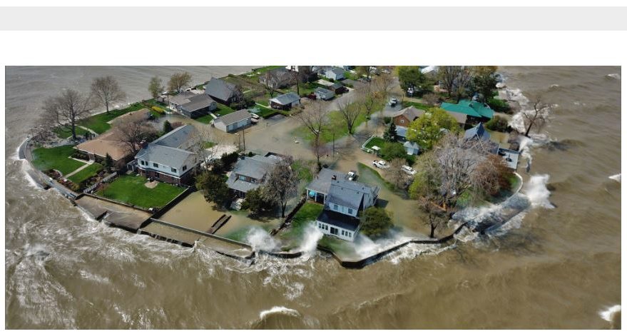
A repository of information compiled to help inform decision-making related to Great Lakes water levels as well as connect people to a variety of informational and planning resources. The web page features four key elements: an FAQ section, informational videos from different offices within USACE, a damage assessment survey, and links to additional resources.
February 2020
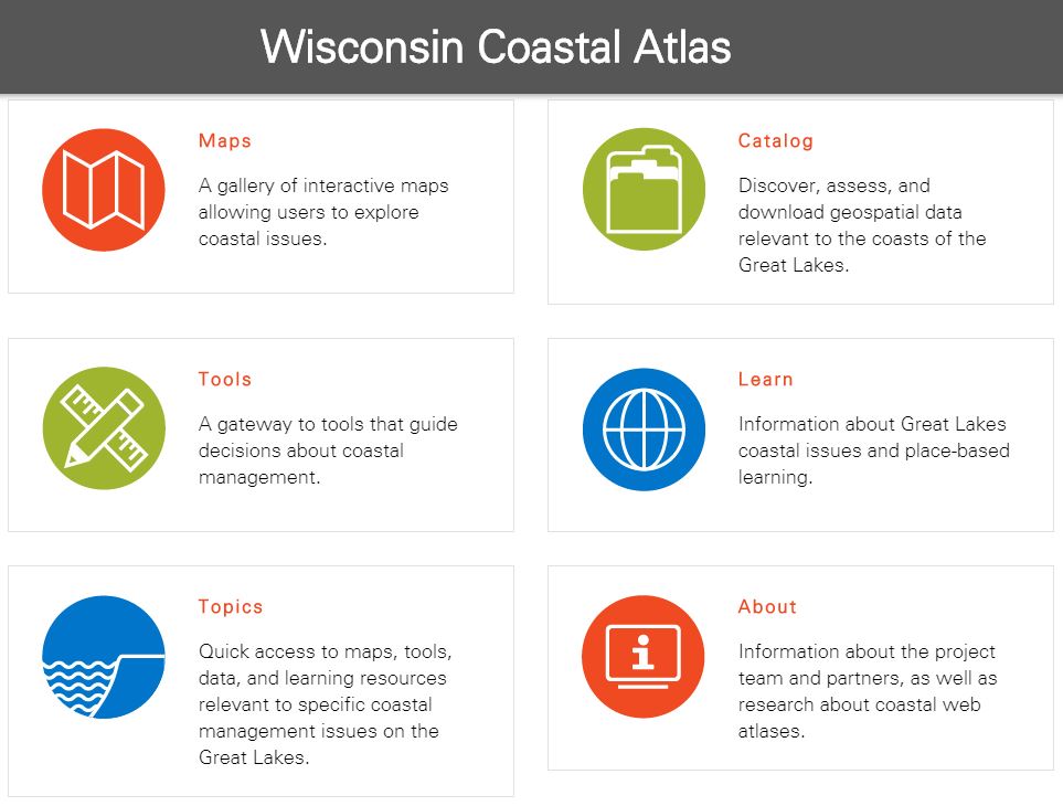
The Wisconsin Coastal Atlas is a technology platform that enables people to better understand coastal issues, share coastal data and inform decision-making about sustainable use of the Great Lakes.The atlas includes five elements: maps, catalog, tools, learn and topics. The atlas serves as a gateway to interactive maps and decision support tools relevant to Great Lakes management and provides access to place-based learning resources about coastal issues in Wisconsin.
January 2020
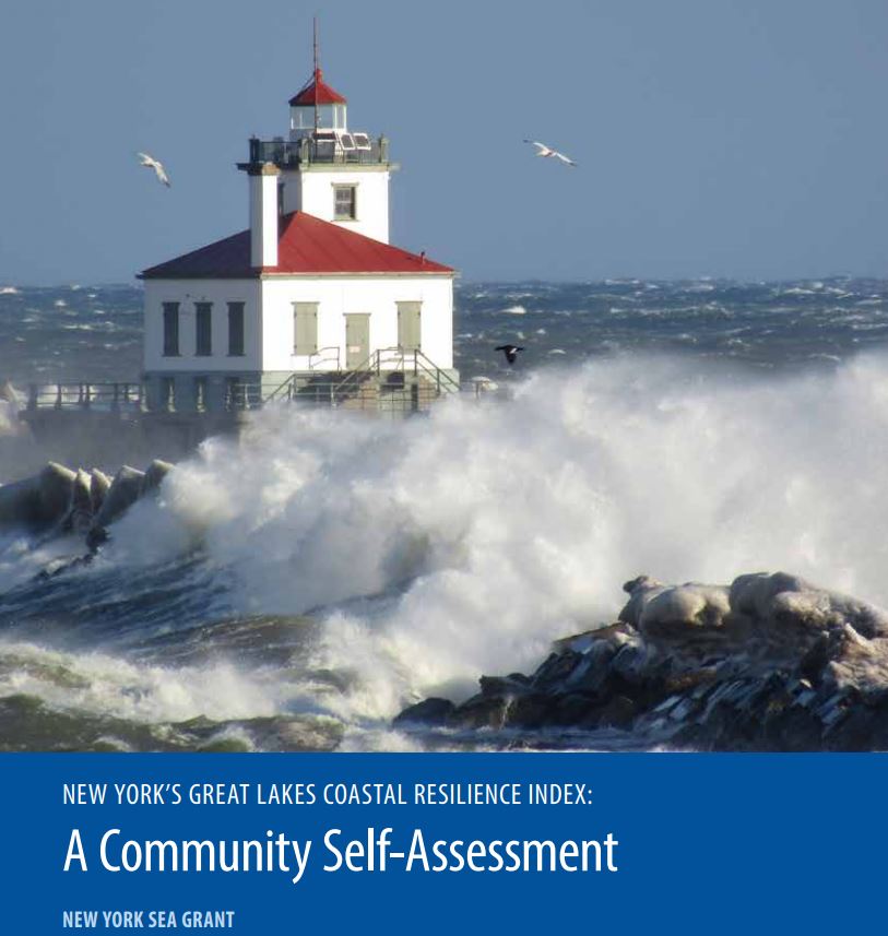 NYSG Great Lakes Coastal Resilience Index
New York’s Great Lakes Coastal Resilience Index is a self-assessment tool developed by the New York Sea Grant Institute to bring community leaders together and provide them with a simple method for identifying areas in which their community can be more resilient to coastal hazards such as coastal flooding and weather disasters. A “yes” or “no” question format helps community leaders investigate vulnerabilities across six sectors: critical facilities and infrastructure, transportation issues, community plans and agreements, mitigation measures, business plans, and social systems.
December 2019
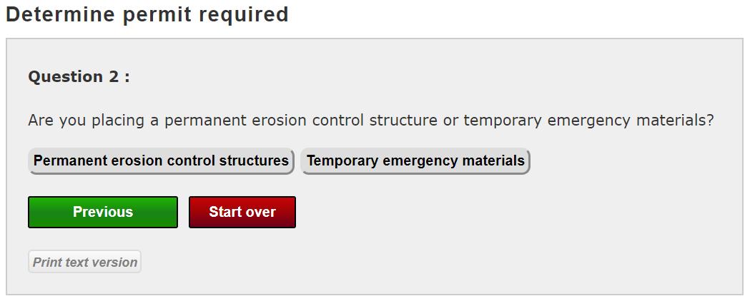 Great Lakes Emergency Erosion Control Self Certification
The Self Certification is a streamlined temporary erosion control placement authorization process intended for emergency situations on Great Lakes shorelines. This process was established to allow homeowners to protect their properties from imminent risk without permitting delays.
November 2019
 Great Lakes Coastal Shore Protection Structures & Their Effects on Coastal Processes
This fact sheet discusses the different types of shore protection and their impacts on coastal processes. This document is written for a broad audience and is intended to help users develop an understanding of Great Lakes coastal processes and how coastal structures can impact coastal processes so that they can make informed decisions when choosing an engineered solution.
October 2019
 Great Lakes Water Level Dashboard
This online, interactive dashboard of monthly water level data for each of the Great Lakes is designed for users to easily examine the fluctuation of the Great Lakes water levels and forecasts at a variety of time scales. The dashboard also includes references for all data, forecasts, and data products.
September 2019
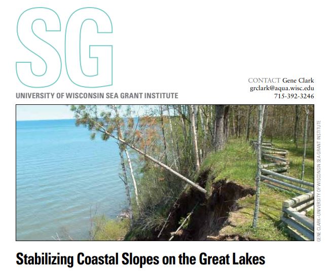 Stabilizing Coastal Slopes for the Great Lakes
This publication discusses topics including visible indicators of erosion and slope instability, management of surface water and groundwater, evidence of soil creep, improving slope stability, and determining a safe setback distance to help users make informed coastal management decisions. The publication also has a list of references to additional information about each topic.
August 2019
Wisconsin Shoreline Inventory & Oblique Photo Viewer – Featuring NEW Bluff Recession Data
This interactive map has been updated to be both a qualitative and quantitative inventory of shoreline conditions on Wisconsin’s Great Lakes coasts. Watch our tutorial to learn how to navigate the map and use the photos, shoreline condition inventories, and recession information to identify and prioritize areas for coastal management.
July 2019
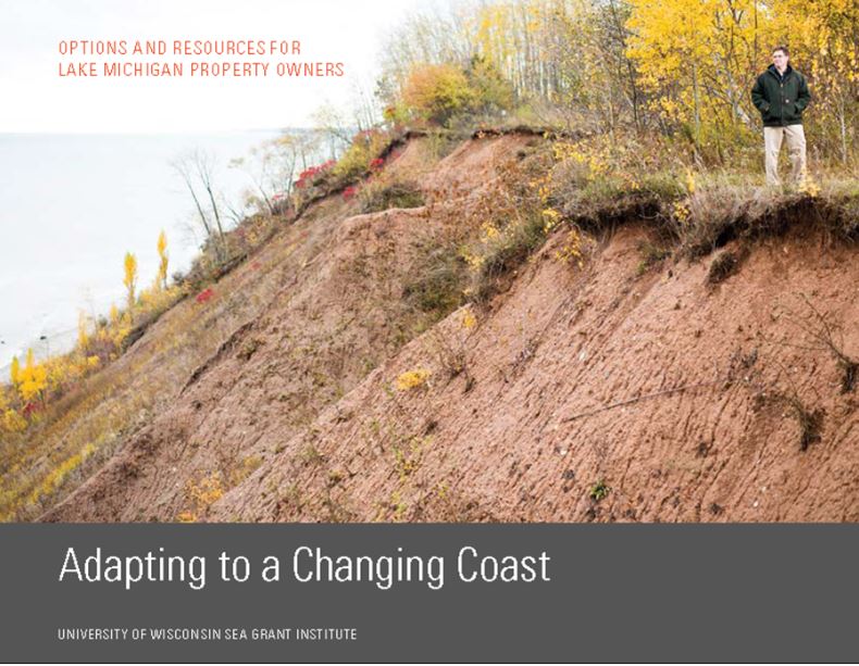 Adapting to a Changing Coast (for Property Owners)
Adapting to a Changing Coast for Property Owners is a booklet that provides property owners with options and resources for responding to the changing bluff and beaches of Lake Michigan. This document presents options, rather than prescriptions, that property owners in Southeast Wisconsin could consider to address coastal hazards.
June 2019
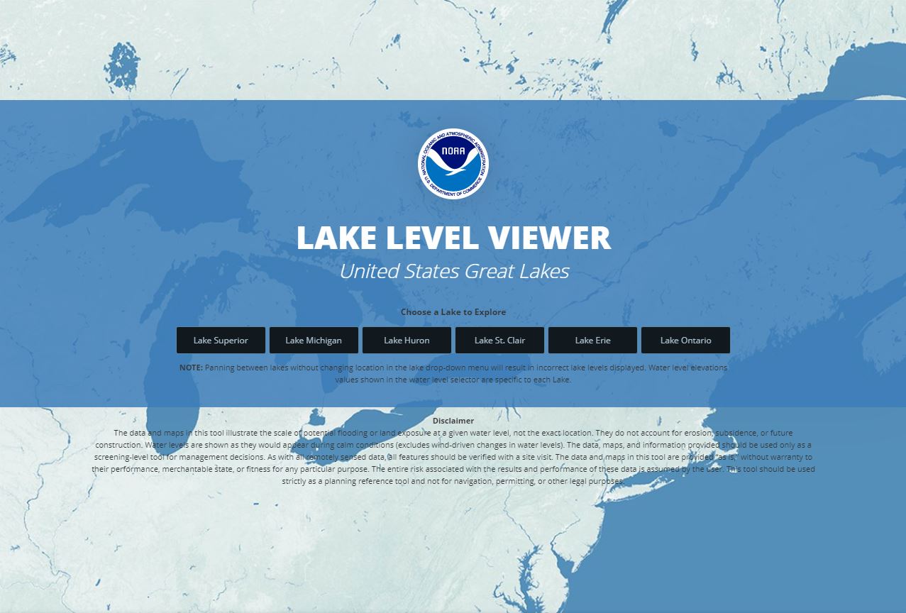
The Lake Level Viewer is a web-based, interactive map used to help users visualize potential Great Lakes water level changes and impacts. The map allows users to pinpoint areas of concern for flooding and heavy erosion in addition to showing potential flooding projected pictures of local landmarks to help officials, and citizens, determine where their community is most vulnerable.
May 2019
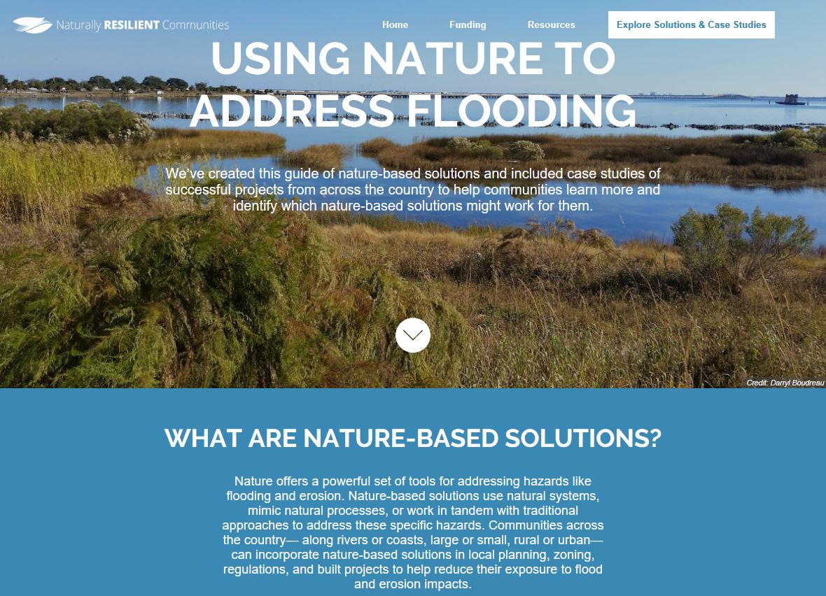 Naturally Resilient Communities
Naturally Resilient Communities is an online guide about nature-based solutions to various coastal hazards. This guide generates a suite of nature-based infrastructure approaches that are specific to the user’s environment and type of issue trying to be addressed such as stormwater flooding or erosion control.
April 2019
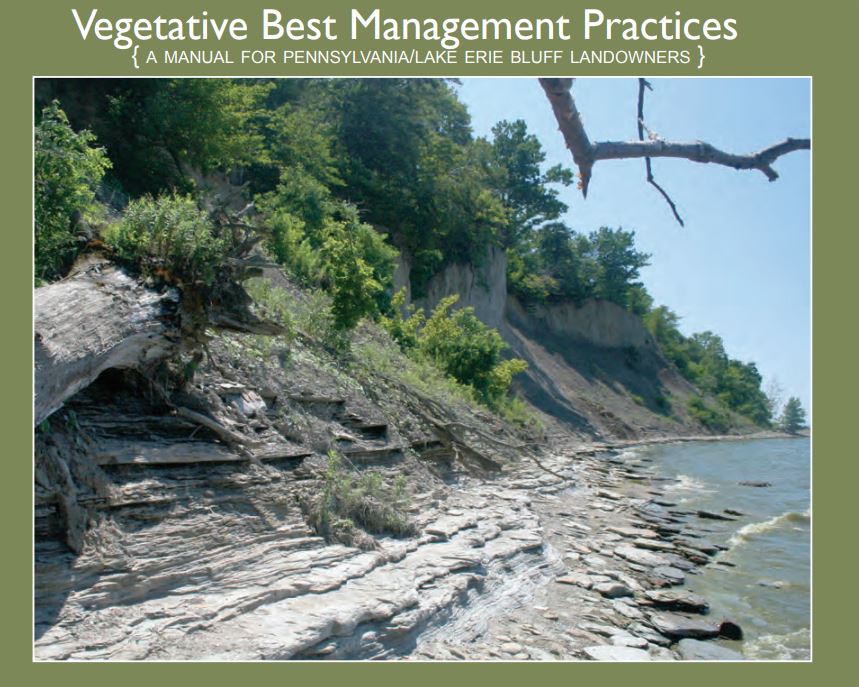
Vegetative Best Management Practices
Vegetative Best Management Practices: A Manual for Pennsylvania/Lake Erie Bluff Landowners is a handbook that provides technical assistance to Lake Erie property owners affected by shoreline erosion and bluff recession. The manual provides recommendations about using vegetation to stabilize coastal bluffs and counteract erosive forces.
March 2019
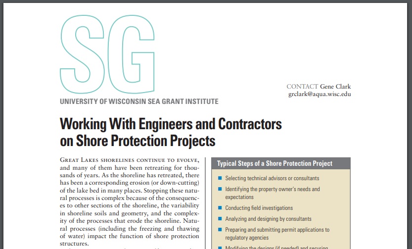 Working with Engineers and Contractors
Working with Engineers and Contractors on Shore Protection Projects is a four page document that highlights the benefits of using an engineering professional or contractor and provides recommendations for finding/choosing a qualified engineering professional or contractor that will fit the needs of the project.
February 2019
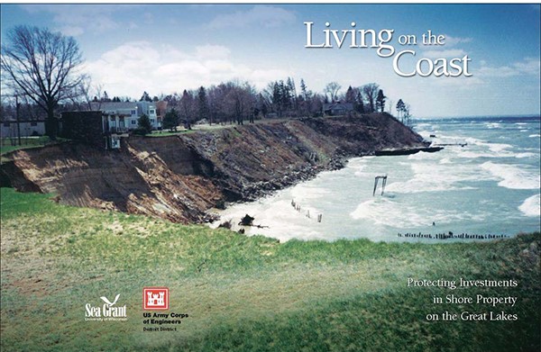
Living on the Coast: Protecting Investments in Shore Property
This booklet provides a brief description of the Great Lakes’ coastal environment as well as recommendations regarding bluff stabilization, controlling surface waters and groundwater, and building sustainable shoreline protection structures. Considerations are included to help engage professionals in implementing long-term stabilization solutions.
January 2019
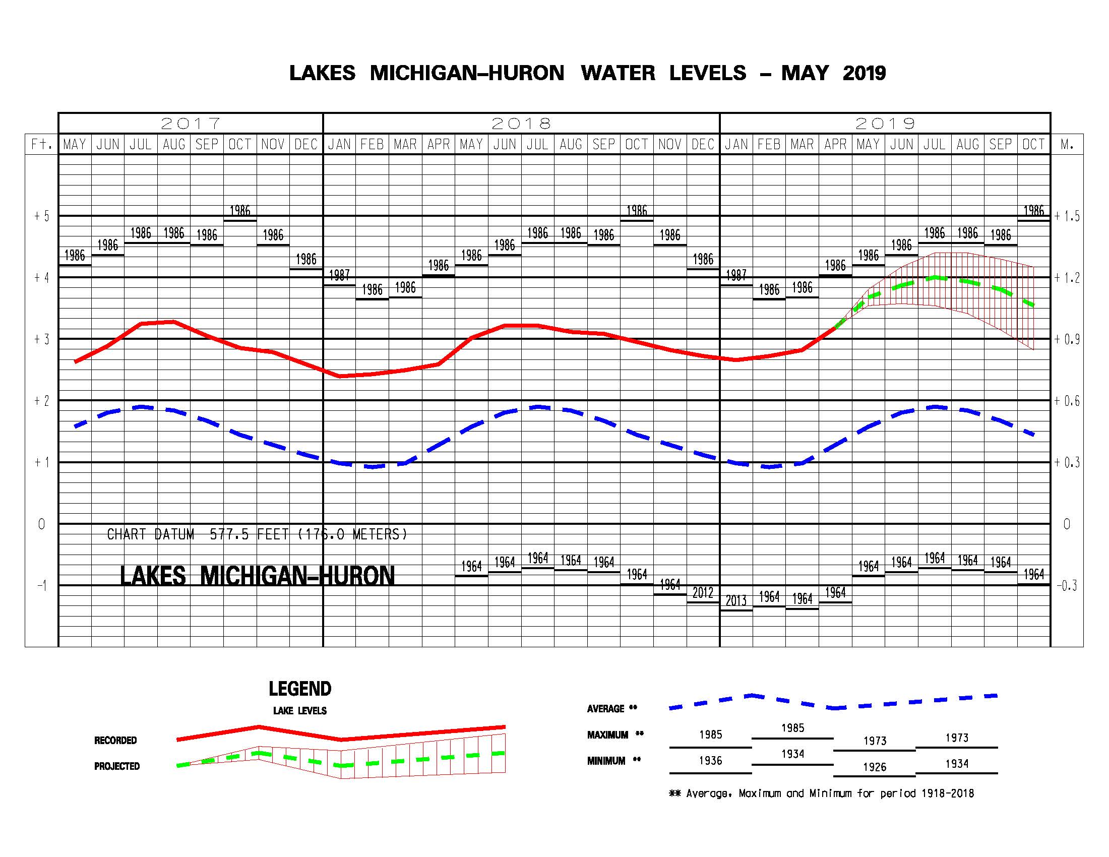 USACE Month Bulletin of Great Lake Water Levels
Published monthly as a public service, this bulletin shows recorded Great Lakes lakes levels from previous and current years, a projection for the next six months, and average and extreme lake levels from 1918 to 2017. In addition to the online figures, the full monthly bulletin, available as a .pdf, provides an explanation of the Great Lakes Basin hydrology for that month.
December 2018
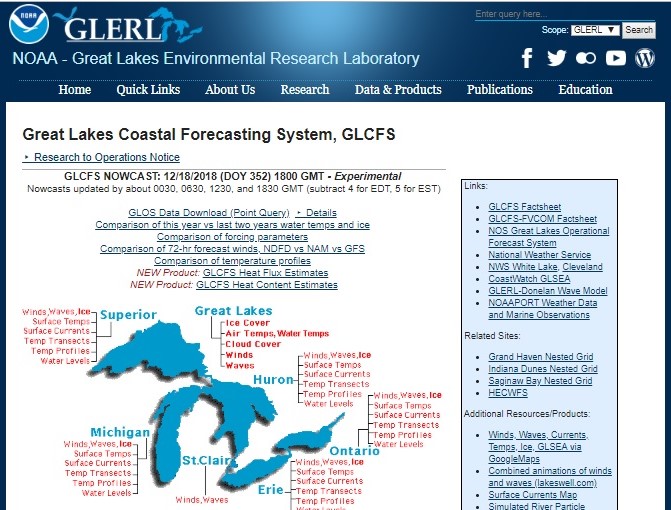 Great Lakes Coastal Forecasting System
The Great Lake Coastal Forecasting System (GLCFS) is a set of online models that predict Great Lakes surface water conditions. 2-D and 3-D web-based maps of lake currents, temperature, wind, waves, ice, and more are available to help users better understand the effects of these conditions on Great Lakes coasts. Users can see current and future surface water conditions on each Great Lake by using the Nowcast and Forecast models.
November 2018
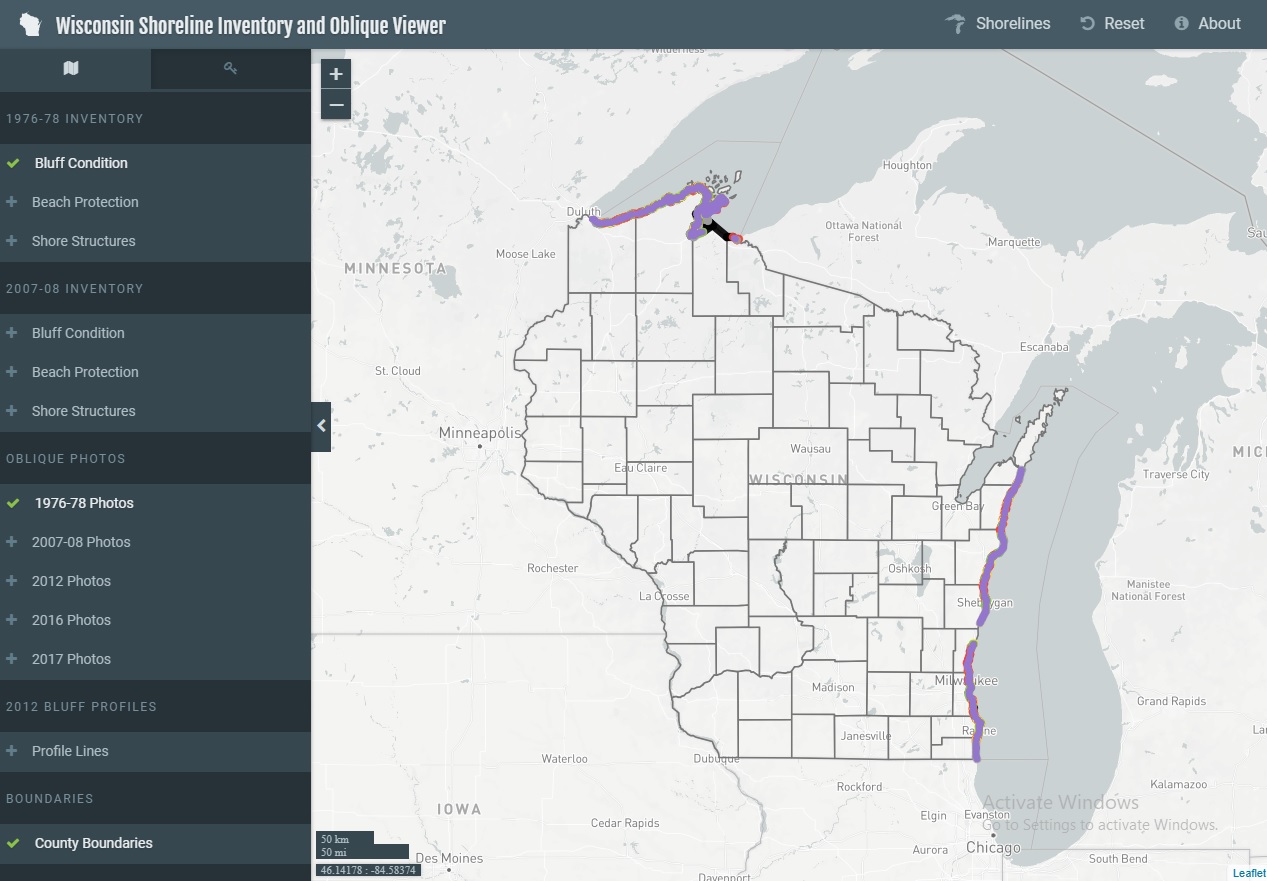 Wisconsin Shoreline Inventory and Oblique Photo Viewer
The Shoreline Inventory and Oblique Photo Viewer is a web-based, interactive map of Wisconsin coastal data that enables users to visualize the temporal changes to Wisconsin’s shorelines. This map is a qualitative inventory of shoreline conditions. Users can click anywhere on the shoreline to learn more about its classification.