


January 25, 2018
By David Hart, Assistant Director for Extension, Wisconsin Sea Grant
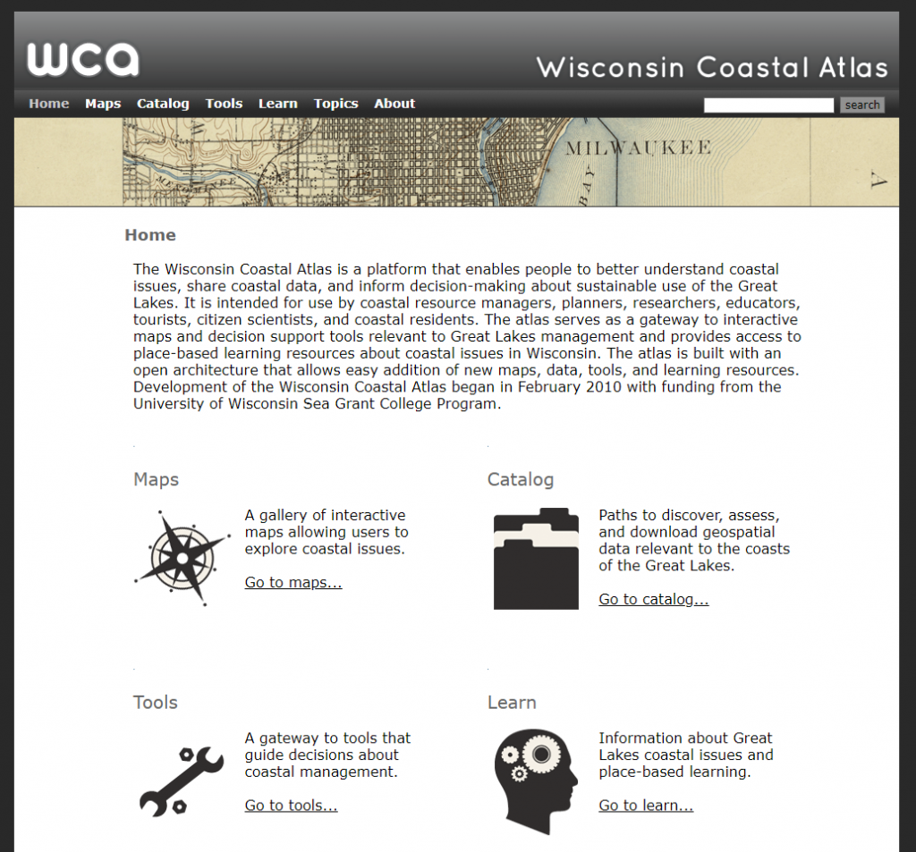
The Wisconsin Coastal Atlas is a technology platform that enables people to better understand coastal issues, share coastal data and inform decision-making about sustainable use of the Great Lakes. It is intended for use by coastal resource managers, planners, researchers, educators and coastal residents. The atlas includes five elements: maps, catalog, tools, learn and topics. These five elements work together to provide access to resources that can help address specific coastal management issues on the Great Lakes, such as building community resilience to coastal hazards.
The Maps element of the atlas provides a gallery of interactive maps with customized perspectives related to specific coastal issues in Wisconsin. An example of an interactive map that addresses resilience to coastal hazards is the “Wisconsin Shoreline Inventory and Oblique Photo Viewer” developed by the Association of State Floodplain Managers with support from the Wisconsin Coastal Management Program. The viewer lets users explore how the Great Lakes coasts of Wisconsin have changed since 1976 by viewing oblique photos and classification of beach and bluff conditions.
The Catalog element of the atlas provides several paths to discover, assess and download geospatial data for the Great Lakes coasts of Wisconsin. Catalog technology platforms include GeoServer – a free and open-source geospatial software server; Open Geoportal – a map-based interface to search, preview and download geospatial data; and GeoNetwork – an interoperable geospatial metadata catalog. The WCA catalog interface also includes a simple data download matrix inspired by the open data catalog at the city of Vancouver, British Columbia, as well as links to a variety of state, regional and national geospatial catalogs. An example of a data set relevant to coastal resilience in the atlas catalog is one including representations of historic bluff tops and toes for seven counties along Lake Michigan.
The Tools element of the atlas serves as a gateway to spatial decision-support tools relevant to coastal management on the Great Lakes. This is accomplished in two ways – first, by linking to innovative decision-support tools for coastal management, and second, by leveraging the spatial data catalog of the atlas to develop new spatial decision support tools. “Visualizing Coastal Erosion on the Great Lakes” is an example of a tool that addresses coastal resilience.
The Learn element of the atlas serves as a repository for place-based learning resources, promotes a stronger understanding of Great Lakes Literacy Principles and provides links to information about Great Lakes coastal issues. The “Great Lakes Coastal Resilience Planning Guide” developed by the Association of State Floodplain Managers as part of the NOAA Digital Coast Partnership is an example of a learning resources that promotes resilience to coastal hazards.
The Topics element of the atlas provides quick access to maps, tools, data and learning resources relevant to specific coastal management issues on the Great Lakes. At this point there are four topics relevant to southeastern Wisconsin included in the atlas – bluff erosion, coastal flooding, beaches and port/harbor/marina infrastructure.
The Wisconsin Coastal Atlas, however, is more than just a Web portal that provides access to coastal maps, tools, data and learning resources – it is also a research project that helps to build a coastal spatial data infrastructure for Wisconsin. The primary motivation of the research is demonstrating that a coastal Web atlas can serve as an interoperable resource both internally and externally. The atlas leverages local government data and integrates it to address regional and statewide issues. In addition, the atlas shares data at broader scales ranging from the Great Lakes to global. The latter is demonstrated through active collaboration with the International Coastal Atlas Network, which utilized a coastal erosion as a use case to show that individual atlases could be searched to access geospatial data as part of a broader global network of coastal atlases.